
Arrive in the late afternoon or early evening.
Accommodation3-star hotel with a swimming pool in Lans en Vercors
Choose which cookies you accept. Privacy policy
Audience measurement
Google Analytics and Matomo cookies — journeys, searches and bookings.
Targeted advertising
Google Ads, Meta and Effinity — conversions, personalised ads and campaign attribution.
Travel assistant
AI-generated answers. Check important information on our information pages, in your contract or with a human advisor at GrandAngle.Travel.
AI answers — when in doubt, ask an advisor.




Fancy a trek in the Vercors lasting 6 or 7 days?
Grand Angle, the trekking agency based in the Vercors, invites you to walk around the Vercors on a self-guided route with 6 days of walking during a 7-day holiday (arriving the day before the first walk)!
A limestone massif in the Pre-Alps, perched between the Drôme and Isère, the Vercors (France’s largest regional natural park) is a true paradise for walkers. Broad, open valleys, extensive forests of fir and spruce, as well as beech and maple, and trails with sweeping views all invite you to recharge… The variety of landscapes surprises walkers: classic mid-altitude mountains, white limestone walls, deep and mysterious gorges, remarkable caves and resurgent springs, and unexpected passages (known as “pas”) through the cliffs, used for centuries. A little higher lies the vast wilderness of the Hauts Plateaux nature reserve, a rugged jumble of limestone and sheep pastures.
For a taste of the landscapes that await you, watch our aerial video of the Vercors, “4 mountains”

Arrive in the late afternoon or early evening.
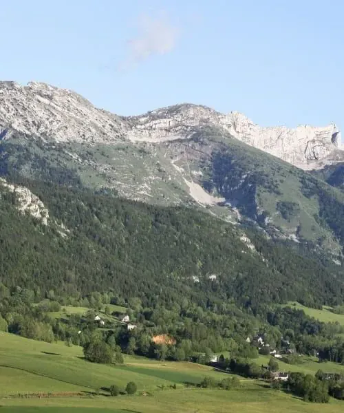
Follow the ridges of the northern Vercors via the Pas de Bellecombe and Pas de l’Ours. From the alpine pastures of La Molière, enjoy superb views across the Alps: no fewer than 7 mountain ranges, including Mont Blanc, unfold before your eyes. A lovely descent through hamlets takes you to Autrans.
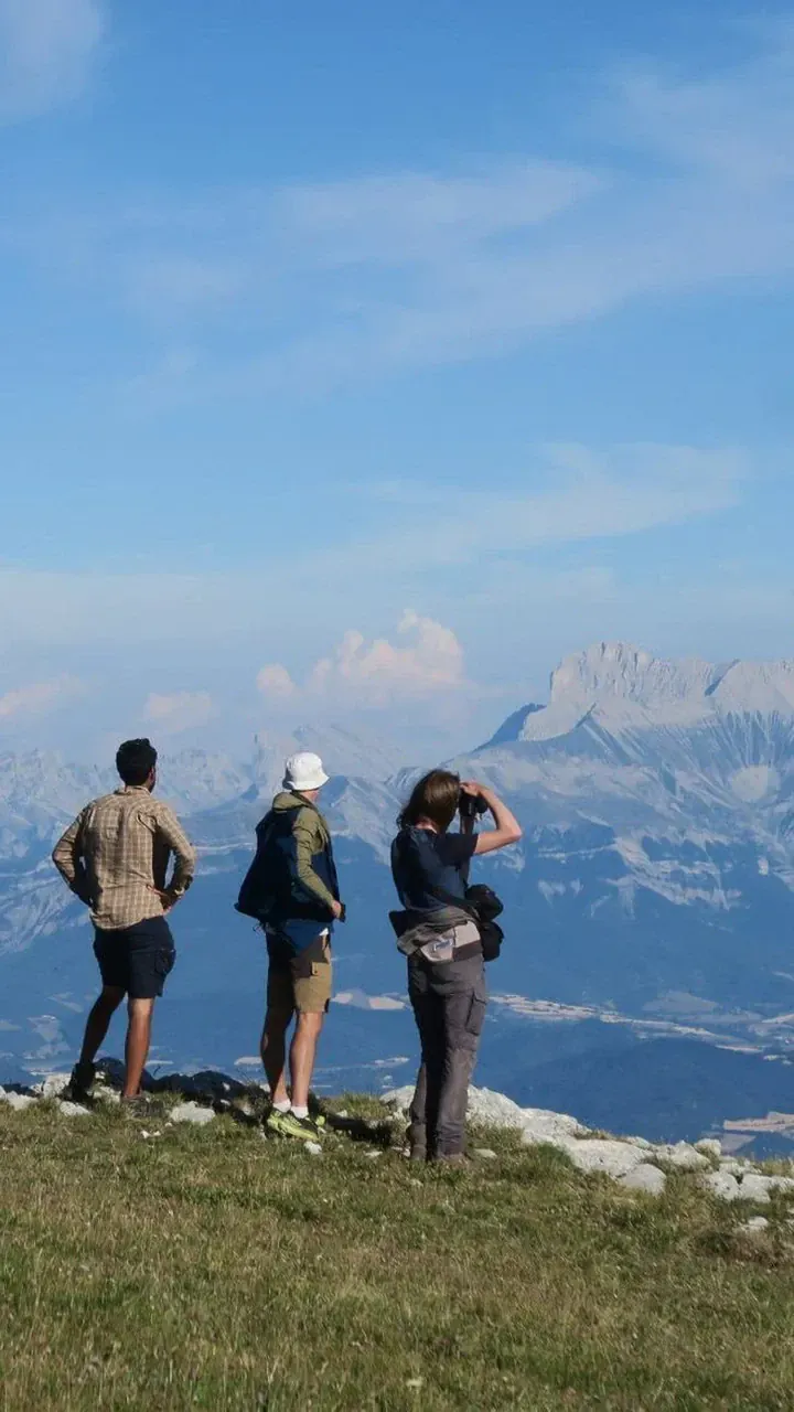
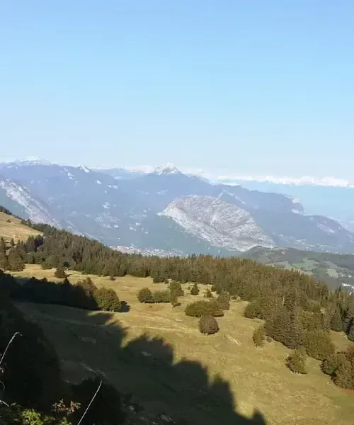
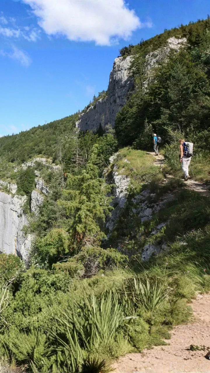
You will cross the Pas de Pertuzon, following the GR long-distance walking route along a very pleasant trail to Rencurel, a small, peaceful rural village.
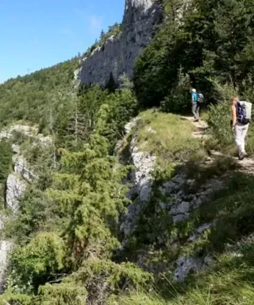
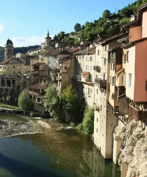
Follow the “Along the Bourne” trail beside the magnificent Bourne Gorges. A day filled with exceptional sights: Choranche and its striking amphitheatre of white cliffs, Choranche and its waterfalls, and, above all, Choranche’s cave, unique in Europe for its thousands of extraordinarily long, slender stalactites… Continue to Pont en Royans, a lively large village with houses suspended above the Bourne.
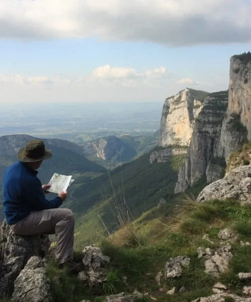
Short transfer to Les Baraques-en-Vercors. A beautiful hike through the Central Vercors via the Belvédère de Révoulat viewpoint. Superb panoramic views across the entire massif, clearly revealing the different sections of this limestone range, cut through by deep gorges. Overnight stay in the village of La Chapelle-en-Vercors.
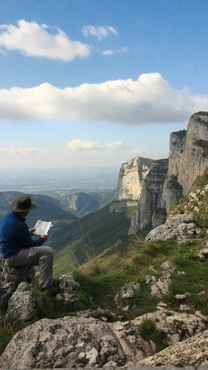
Short transfer to Saint-Martin-en-Vercors. Walk to Bois Barbu, above Villard-de-Lans, via the Pas de Saint-Martin, the Herbouilly plain and the ruined village of Valchevrière.
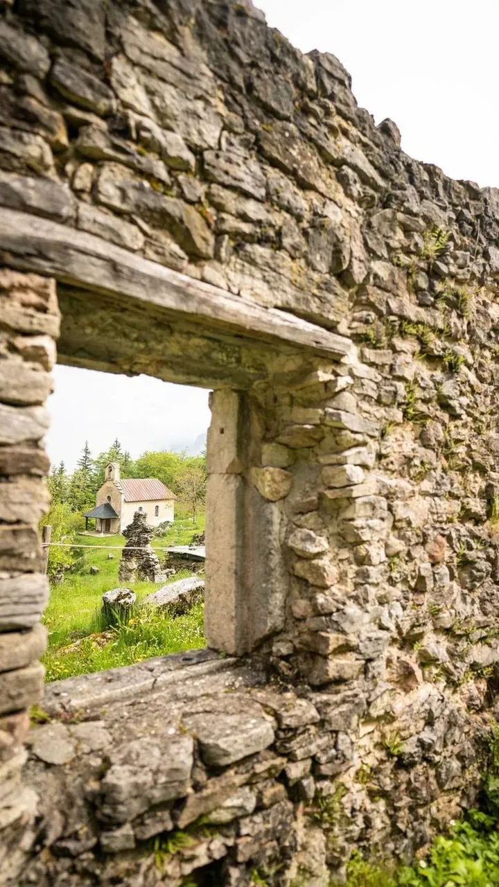
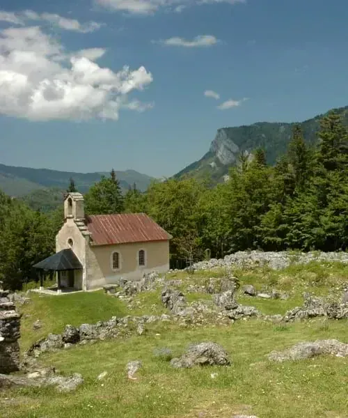
Short transfer to the hamlet of “La Conversaria”, above Villard-de-Lans. You can either reach Lans via the Machiret meadows and the Col de l’Arc. The Col de l’Arc is a superb, easily accessible mountain pass, offering magnificent views over Belledonne and the Oisans. Alternatively, also starting from La Conversaria, you reach the Sentier Gobert after a steep climb that will certainly warm you up for the day, then continue via the Pic Saint-Michel. The Sentier Gobert is a magnificent “nature trail” where you can discover the typical flora of the Northern Vercors, following a balcony path overlooking the entire Villard valley. The Pic Saint-Michel is one of the peaks of the Northern Vercors, offering an outstanding view of the entire Alps and the Northern Vercors.
The trip ends after the hike in Lans-en-Vercors.
We may occasionally need to change the itinerary shown, either for logistical reasons (accommodation capacity issues, changes in ground conditions, rockfalls, damaged trails, etc.) or because of weather conditions. These changes are always made in your best interests, for your safety and greater comfort!
| From | To | Price per person |
|---|---|---|
| 12/05/2027 | 27/06/2027 | 990 € |
| 28/06/2027 | 31/08/2027 | 1030 € |
| 01/09/2027 | 15/09/2027 | 990 € |
Cécile Henard
Travel expert in France and Switzerland
Estelle Torterotot
Travel expert in France and Switzerland
For moderately experienced to strong walkers with a good level of fitness. The stages present no major technical difficulties but are fairly long. From 5 to 7 hours of walking per day, with an average daily ascent of 350 to 1000m.
You only carry your picnic lunch and the belongings you need for the day. Your luggage will be waiting for you at the hotel each evening.
Available for groups of 2 people or more.
7 days / 6 nights, 6 days of walking
A self-guided trip without a guide; we provide a digital travel pack containing access to our smartphone navigation app, a list of your accommodation, any relevant vouchers and all the information you need for your trip to run smoothly.
If you wish, we can send a printed travel pack with maps and route notes for a supplement of 35 € per pack. For requests made less than 45 days before departure, or for travellers outside France, we will make the pack available at the first hotel.
In 2* hotels and 3* hotels (3 nights), in rooms for two. Several hotels have a swimming pool.

Room, swimming pool and exterior of the Hôtel du Col de l’Arc in Lans-en-Vercors

Exterior, room and restaurant of the Hôtel Le Vernay in Autrans

Room, swimming pool and exterior of the Hôtel Le Marronnier in Rencurel
Half board: breakfasts and hot dinners are served. Lunches are not included.
You can buy supplies for your picnic lunches in Lans-en-Vercors, Autrans, La Chapelle-en-Vercors and Pont-en-Royans. You can order picnic lunches from the hotels by letting them know the day before. The hotel in Rencurel, however, asks for 2 days' notice if you would like picnic lunches. There are no shops in Rencurel.
Please tell us about any food allergies or special dietary requirements when booking; we will do our best to adapt your meals.
In France, increasing numbers of hotels and guesthouses choose not to have an official rating, including establishments that were still rated a year or two ago. This does not mean their quality has declined—far from it. Many of the guesthouses are charming places to stay.
If we indicate, for example, a comfort level of “3* or equivalent”, this means that the property does not necessarily have an official rating, but offers comfort comparable to that of a 3* hotel.
On Day 1 in the afternoon in Lans-en-Vercors.
On Day 7 in the afternoon, after the hike, in Lans-en-Vercors.
Lyon Saint-Exupéry Airport is one option for reaching the region. Check current coach or rail connections to Grenoble before booking.
Travel by train to Grenoble, then continue by regional coach or taxi to the start of the walk. Check current train times on SNCF Connect and local coach connections on Cars Région before booking.
From Grenoble, Lans-en-Vercors is easy to reach using the Transisère buses, which run at intervals.
Route T64 connects Grenoble to Lans-en-Vercors (Office de tourisme stop). Check the official Cars Région timetables before you travel.
Take the A48 motorway from Lyon towards Grenoble, leaving at exit no. 14 for Saint-Égrève, then follow signs for Villard-de-Lans (via Sassenage). In Lans-en-Vercors, turn left towards the village centre to reach your hotel.
You can check your route on ViaMichelin.
In Lans-en-Vercors, in your hotel’s car park.
A number of our trips offer opportunities to swim, either during the day’s route or at the end of the day. It would be a shame to miss out. However, we emphasise that you alone must decide whether it is appropriate to swim; any swimming is therefore your own responsibility and undertaken at your own risk.
Since 2012, Grand Angle has been a member of ATR, the leading association for more responsible tourism. We design our trips—on foot, by bike and on snow—to invite everyone to discover the world differently: with curiosity, respect and kindness.
As a member of the board of directors since 2018, we actively help the sector move towards more meaningful practices. In practical terms, we focus on:
We also share the values of the Traveller’s Ethical Charter, which encourages everyone to take simple steps to protect the places they visit and enjoy meaningful encounters.
Since 2025, Grand Angle has been recognised as a Travelife Partner, an international label that certifies our responsible environmental, ethical and sustainable management practices, both within our company and in our work with partners and the organisation of our trips.
This label, the second level of a rigorous international certification scheme, recognises our practical efforts to support responsible tourism. We are actively working towards the next level, Travelife Certified, in line with our sustainable development policy
In this section, you will find links to products from our partner Alpinstore, a French online retailer specialising in outdoor equipment, based in Annecy.
Carrying your belongings
Read our magazine article on how to pack your hiking backpack.
For hiking
Note: synthetic technical clothing performs very well. New merino wool clothing is also available; it performs very well, is comfortable to wear and has the advantage of resisting sweat odours! As a general rule, avoid cotton, which chills you when wet.
For your picnic lunch
Protection from sun and rain
After your walk
You can find these tips in our article #"What to pack for a hike".
This list is intended as a guide and should be adapted to your trip and the season in which you travel.
Vercors Regional Natural Park: 0476943826
Lans Tourist Office: 0476954262
Villard-de-Lans Tourist Office: 0476951038
Check the travel documents and any visa requirements that apply to your nationality before departure. The official France-Visas information is a useful starting point; requirements also apply to children.
The Vercors generally has a mountain climate; however, it straddles the climatic boundary between the Northern Alps (the Isère catchment area) and the Southern Alps (the Drôme catchment area), broadly located at the Col de Rousset. Rainfall is brought by weather systems from the west and north-west. While the northern part receives a fairly constant amount of precipitation throughout the year (around 100 mm per month, reaching 1500 mm per year in Autrans or Bouvante) and has a predominantly oceanic climate, the southern part sees a summer dip in rainfall (less than 50 mm in July and August, less than 900 mm per year in the Diois) and abundant sunshine, with a predominantly Mediterranean climate whose influence extends into southern Trièves, the Diois, the Gervanne and even some areas of the Royans.
In winter, precipitation usually falls as snow because of the altitude. The amount of sunshine the slopes receive, cloud cover and prevailing winds are also important factors. Temperatures of −15 °C are not uncommon in Autrans. The lowest temperature recorded in Isère was in fact measured in Villard-de-Lans on 7 January 1985, at −28 °C. However, averages over a thirty-year period range from −5 °C in winter to +15 °C in summer.
Here are a few interesting websites to help you learn more about the Vercors
www.parc-du-vercors.fr and https://www.alpes-isere.com/decouvrir-l-isere/grands-lacs/trieves/
And a few books
A la découverte du Vercors, Parc Naturel Régional, published by Glénat, by François Ribard (a Grand Angle walking guide)
Vercors Regional Natural Park has published a collection of photographs of the Hauts Plateaux reserve entitled “Vercors d’en haut”, with commentary by Daniel Pennac.
Finally, if you are interested in history, the local history association in Lans-en-Vercors has published 3 issues of Cahiers du Peuil, in a series entitled Jadis, au pays des Quatre Montagnes, at an indicative price of 13 euros per issue.
All these publications, and many others, are available from tourist offices and bookshops in the Vercors.
IGN Top 25 maps:
Estimated carbon footprint per traveler, in kg CO₂ equivalent.
4,6 · 47 reviews
Christophe 9/28/26
— A beautiful, very well-organized route with some great stops!
Bernard 12/27/25
— A beautiful walk through the Vercors. Ideal for discovering this magnificent region.
—
— Reply from the team
Patrick 12/27/25
— Magnificent sites, well-designed route, quality accommodation. The guidebook should mention the long and arduous descent on D4 from the Belvédère du Ranc, and the duration of the hike on D4 is grossly underestimated.
Claude 6/23/26
— A very interesting hike with varied scenery
—
— Reply from the team
Would you like to make this a private trip?
Travel with friends or family on dates that suit you. Tell our specialists what you have in mind.

From €1,180
4,6 · 20 reviews

From €1,010
4,3 · 21 reviews

From €1,120
4,8 · 57 reviews

From €2,815
4,9 · 16 reviews

From €545
5 · 2 reviews

From €515
5 · 3 reviews
Your next adventure
Confirmed trips only
No trip matches — let us guide you Need help choosing?
Call us


