The Corniche des Maures and the Îles d’Or

Booking dates are not currently available for this trip. Please check back soon or contact us to plan your journey.
5 · 2 reviews
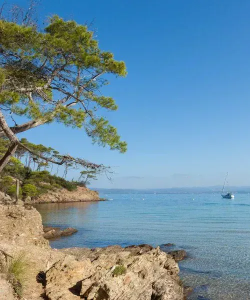
Rocky cove on Porquerolles island - France
Bay and islet of Port-Cros island - Var - France
Beach and crystal waters of Iles d'Or - Var - France
Prickly pear cactus under a blue sky - Corniche des Maures - Var - France
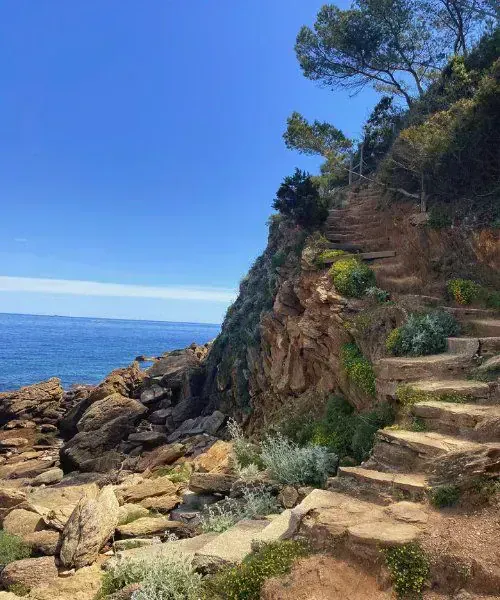
Coastal path in Bormes-les-Mimosas - Var - France
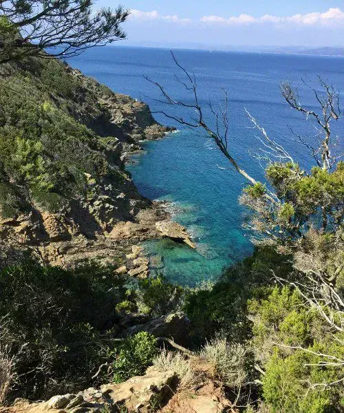
Cove and sea from the coastal path - Corniche des Maures - Var, France
Map FRAGP0056
Pine tree leaning over a turquoise cove - Porquerolles island - Var - France
Hiker on a rocky coastal path - Var - France
Hillside village of Bormes-les-Mimosas - Var - France
Palm trees against the blue sky - Var - France
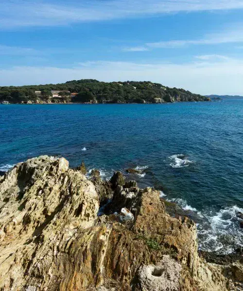
Panoramic view of Iles d'Or - Var - France
Rocky coast of Porquerolles island - Var - France
Turquoise cove and sailboats seen through pines - Port-Cros island - Var - France
Hotel Le Lavandou - Var - France

The Massif des Maures forms a wild coastline where forests of cork oak and maritime pine meet the waters of the Mediterranean. Away from the summer bustle, this region’s mild climate makes it an ideal setting for walking, with unspoilt coastal trails and views of the Îles d’Or, an archipelago with a distinctive island character.

This trek in Provence takes you to discover Port-Cros, at the heart of Europe’s first national park encompassing both land and sea, and its neighbour Porquerolles. Each stage reveals a different side of the area, from the geological curiosity of the Giens peninsula to the views from ridges overlooking the sea. Designed as a single-centre holiday for greater comfort, this trip, one of our guided walking holidays in France, fully immerses you in the unique landscapes of the Var’s coastal corniche, led by your guide.

Itinerary

Elevation profile

Elevation profile · J1 — Notre Dame de Constance 120–320 mElevation

Hover or touch the profile to read the elevation. Keyboard: left and right arrows, Home and End. Escape clears the cursor.

Elevation profile · J2 — L’île de Port-Cros 1–127 mElevation

Hover or touch the profile to read the elevation. Keyboard: left and right arrows, Home and End. Escape clears the cursor.

Elevation profile · J3 — Caps Lardier et Taillat 1–102 mElevation

Hover or touch the profile to read the elevation. Keyboard: left and right arrows, Home and End. Escape clears the cursor.

Elevation profile · J4 — Ile de Porquerolles → Est 2–107 mElevation

Hover or touch the profile to read the elevation. Keyboard: left and right arrows, Home and End. Escape clears the cursor.

Elevation profile · J4 — Ile de Porquerolles ouest 0–104 mElevation

Hover or touch the profile to read the elevation. Keyboard: left and right arrows, Home and End. Escape clears the cursor.

Elevation profile · J5 — Le sentier littoral → Fort de Bregancon 0–32 mElevation

Hover or touch the profile to read the elevation. Keyboard: left and right arrows, Home and End. Escape clears the cursor.

Elevation profile · J6 — Presqu’île de Giens 0–103 mElevation

Hover or touch the profile to read the elevation. Keyboard: left and right arrows, Home and End. Escape clears the cursor.

Program

Meet your guide at 13:45 outside Hyères railway station, or go directly to the hotel at 14:15. Your guide will join you there after welcoming the other participants at the station (the hotel’s contact details will be provided in your joining instructions). Please indicate your meeting point when booking. Wear clothing suitable for walking.

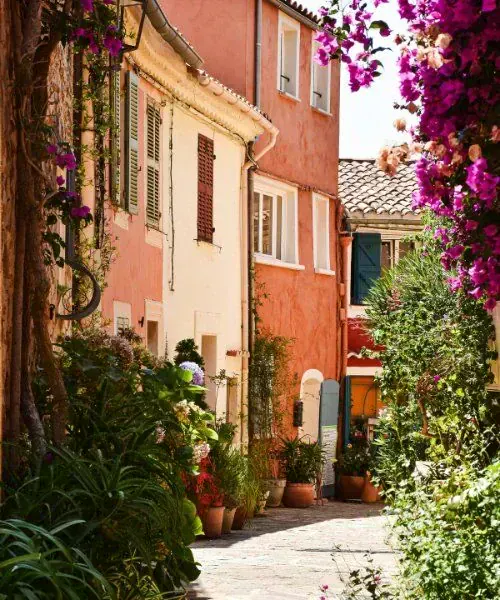
Transfer to your hotel in Le Lavandou (a journey of around 30 minutes). Settle in and drop off your luggage, then set out on an introductory walk from Bormes-les-Mimosas (10 minutes away by minibus) towards the chapel of Notre-Dame de Constance, which overlooks the village and offers outstanding views of the coast and the Îles d’Or. Afterwards, explore the lanes of this iconic village at your own pace. From January to March, the mimosa, with its small yellow flowers, should be in full bloom.
Accommodation3* hotel
Distance4km
InfoWalking time: 2h
D+Ascent: 190m
D-Descent: 190m

A day exploring the island of Port-Cros, reached by boat from the port of Le Lavandou. Enjoy a walk in Europe’s first national park encompassing both land and sea, with its protected environment and beautiful landscapes. The day ends at the island’s small harbour, where we will wait for the boat back to the mainland.

Accommodation3* hotel
Distance10 to 12km
InfoWalking time: Between 4 and 5h
D+Ascent: 300 to 350m
D-Descent: 300 to 350m

Transfer to Héraclée, near Ramatuelle (approximately 45 minutes by road). Walk along the coastal path towards Gigaro beach, then on to the unspoilt coves of Cap Lardier and Cap Taillat, areas protected by the Conservatoire du littoral and among the last stretches of Mediterranean coastline to remain in their natural state. Return to Le Lavandou by minibus at the end of the walk.

Accommodation3* hotel
Distance13km
InfoWalking time: Between 4 and 5 hours
D+Ascent: 350m
D-Descent: 350m

Depart by boat from Le Lavandou for a day exploring Porquerolles Island. This protected island is an example of harmony between people and nature. Set off on a walk towards the southern coast, where you will discover the main lighthouse, the Langoustier headlands and Plage d’Argent. Return to the mainland at the end of the day.

Accommodation3* hotel
Distance13 to 15km
InfoWalking time: Between 4 and 5 hours
D+Ascent: 300 to 350m
D-Descent: 300 to 350m

Short minibus transfer after breakfast to Les Salins, a remarkable coastal site for birdlife. The path follows the coastline and the salt marshes, ranked among the Var’s most valuable natural sites. More than 350 bird species and nearly 300 varieties of plants contribute to the area’s exceptional biodiversity.

The route continues to Plage de l’Argentière, the starting point for a beautiful coastal walk alternating between beaches and rocky headlands: Pellegrin, Léoube, L’Estagnol, Cabasson… continuing to the foot of Fort de Brégançon, the summer residence of French presidents.

Accommodation3* hotel
Distance14km
InfoWalking time: 4 hours
D+Ascent: 75m
D-Descent: 75m

A day dedicated to exploring the Giens Peninsula, linked to the mainland by two coastal sandbars, each 4km long: a double tombolo unique in the Mediterranean and one of the coast’s most remarkable natural features.

After a transfer of approximately 45 minutes (participants who arrived by car follow in their own vehicles), walk around the western tip of the peninsula: Plage de l’Aygade, with its mix of pebbles and sand, Pain de Sucre, Pointe des Chevaliers, Pointe Escampobariou, then the village of Giens, located in the heart of the peninsula.

At the end of the walk, transfer to Hyères SNCF railway station (approximately 20 minutes), arriving at 16:30 for participants travelling by train. Allow sufficient time between the end of the trip and your train’s departure.

Distance10
InfoWalking time: 4 hours
D+Ascent: 200m
D-Descent: 200m

We may need to change the itinerary shown, either for organisational reasons (accommodation capacity issues, splitting groups, changes in ground conditions, rockfalls, damaged trails, etc.) or at the guide’s discretion (weather, the group’s ability, etc.). These changes are always made in your best interests, for your safety and greater comfort!

Dates, prices and booking

Booking dates are not currently available for this trip. Please check back soon or contact us to plan your journey.

Ask about upcoming departures

Availability update: Departures and prices for the 2027 season have not yet been confirmed. This trip cannot currently be booked for 2027. Please contact Grand Angle for an update before arranging travel.

Price includes
  • Accommodation,
  • Meals from dinner on day 1 to lunch on day 6
  • Guide services,
  • Scheduled land transfers by minibus or reimbursement of expenses for using your own car,
  • Scheduled sea transfers,
  • Tourist taxes.
Price excludes
  • Travel to and from the trip
  • Drinks
  • Admission fees to sites
  • Personal expenses
  • Insurance
  • Booking fees
  • Optional guide gratuities.
  • Anything not listed under “Prices include”

Options & supplements

Options and supplements will be confirmed when new departures are released.

Your advisor

Cassandre Dufour

Cassandre Dufour

Travel Advisor

Write

Technical and practical information

Easy to moderate. Daily distances range from 10 to 15km, with 4 to 5 hours of walking, with no technical difficulties, along coastal paths and forest tracks. Daily ascent is generally between 250 and 350m, with just one slightly more demanding day reaching 600m. The terrain can be rocky, especially on the coastal paths, as well as sandy. Overall, the walks are manageable thanks to the relatively short daily stages.

You only need to carry a daypack with your belongings for the day, your picnic lunch and snacks for the walk. Luggage is transported by vehicle.

Transfers are by minibus driven by your guide, for up to 8 participants. Beyond this limit, only people who have their own vehicle and agree to use it to reach the starting points of the walks can book. An expense reimbursement of 70 € per car will then apply, covering approximately 115km travelled between day 1 and day 5.

Rooms accommodate 2 people. You can choose a single room, subject to availability.
The *** hotel in Le Lavandou is in a quiet residential neighbourhood, 200m from the beaches and 100m from the shops. The hotel has an outdoor swimming pool (from March to October). This historic Provençal building dating from 1890 is surrounded by a lovely exotic garden where you can relax.

Hotel Le Lavandou

Breakfasts at the hotel and dinners at a partner restaurant on the seafront, a 5-minute walk away. Picnic lunches from your daypack at midday.
Please let us know of any food allergies or special dietary requirements when booking; we will do our best to adapt your meals.

Guide services

Provided by a state-qualified mountain walking guide.

4 to 15 people

Guide gratuities are optional and at your discretion. To reward outstanding service, a suggested guideline is 5–10% of the total trip cost. Local currency is preferred.

6 days, 5 nights, 5 days of walking.

Meeting point / End of trip

Meeting point

On Day 1 at 13:45 outside Hyères SNCF railway station, or directly at the hotel at 14:15.

End of trip

On Day 6 at around 16:00 on the Giens peninsula or around 16:30 at Hyères SNCF railway station.

If you would like to book an extra night at the accommodation used for your trip, please contact us for the contact details.

By train

Direct TGV trains to Hyères or via Toulon, followed by a regular bus service, Zou route 83 Toulon / St Tropez no. 7801, getting off at the “Square des Héros” stop in Le Lavandou. The hotel is 50 metres away.
Timetables for departmental bus routes are available on the Var Departmental Council website, on the ZOU website
ZOU! bus timetables in the Var, one-way ticket fare: 3 euros

The hotel in Le Lavandou is very close to the town centre.

Free, unguarded parking spaces are available on the hotel’s street and in neighbouring streets.

A number of our trips offer opportunities to swim, either along the way or at the end of the day. It would be a shame to miss out. However, we stress that you alone must decide whether it is appropriate to swim; you therefore swim at your own risk and are responsible for your own safety.

Member of Agir pour un Tourisme Responsable (ATR)

Since 2012, Grand Angle has been a member of ATR, the leading association for more responsible tourism. We design our trips – on foot, by bike and on snow – to invite everyone to discover the world differently: with curiosity, respect and kindness.

As a member of the board of directors since 2018, we actively contribute to making the sector’s practices more meaningful. In practical terms, we focus on:

  • Transparency in our practices and pricing
  • Respect for our partners and local communities
  • Protecting the environment on every trip

We also share the values of the traveller’s ethical charter, which encourages everyone to take simple steps to protect the places they visit and enjoy meaningful encounters.

Travelife Partner

Since 2025, Grand Angle has been recognised as a Travelife Partner, an international label that certifies our responsible environmental, ethical and sustainable management practices, both within our company and in our work with partners and the organisation of our trips.

This label, the second level of a rigorous international certification programme, recognises our concrete actions in support of responsible tourism. We are actively working towards the next level, Travelife Certified, in line with our sustainable development policy

Luggage

  • 1 backpack with a capacity of 35 to 40 litres, a ventilated, adjustable back panel and a hip belt, large enough to hold the day’s food, a water bottle, a protective layer, a camera…
  • 1 soft travel bag (no hard-shell suitcases) to hold your changes of clothing for the week, to be handed over to the luggage transport team. Please note! Only 1 bag per person, weighing no more than 10 kg. Any excess baggage may be refused.

Clothing
For hiking

  • for maximum comfort, choose a layered clothing system: warm base layers (leggings + top) such as “Carline” or “Capilene” (hollow fibres that wick away perspiration) + a sweatshirt or fleece jacket + a mountain jacket and overtrousers with a waterproof, breathable membrane (such as Gore-Tex or equivalent) for bad weather.

In general, except in hot climates and countries, avoid cotton, which holds moisture close to the body (and dries slowly), and choose suitable synthetic fabrics instead.

  • canvas trousers
  • shorts
  • T-shirts
  • 6 to 7 pairs of hiking socks
  • 1 rain poncho covering both you and your backpack.

If you have high-performance outerwear (see above), you may only need a rain cover for your backpack. An umbrella is less practical, especially in windy weather or thunderstorms…

  • 1 sun hat, ideally a cap with a peak and neck flap
  • 1 scarf to protect you from the sun and/or wind
  • 1 warm hat and 1 pair of gloves; depending on the season and altitude, always keep these at the bottom of your bag

For overnight stops

  • changes of clothing and comfortable shoes
  • “Quies” or “Ear” earplugs
  • basic toiletries + towel + swimwear. In general, your clothing should suit the season and your chosen region.

Miscellaneous equipment
For hiking

  • 1 pair of hiking boots with a waterproof, breathable membrane (such as Gore-Tex or equivalent) that feel comfortable! Break in new boots before setting off on a hike by wearing them for a few weeks beforehand to avoid the discomfort of blisters and chafing…
  • 1 (or even 2) pair of sunglasses with lenses rated at least category 3.
  • 1 large, strong plastic bag to wrap clothing and belongings inside your backpack (in case of heavy rain)
  • 1 water bottle, preferably insulated, with a capacity of at least 1 litre. Drinking water is essential when hiking; 2 bottles holding 1 to 1,5 litre each will certainly come in handy in summer and/or in hot, dry regions.
  • 1 folding knife, such as a Swiss Army knife + cutlery + cup - 1 Tupperware-style bowl with a lid for picnics.

Le Lavandou Tourist Office: 0494004050, www.lelavandou.eu
Bormes Tourist Office: 0494013838, www.bormeslesmimosas.com
Hyères Tourist Office: 0494018450, www.ot-hyeres.fr

Environment

The islands of Port-Cros and Porquerolles are part of a national park where the utmost respect for the environment is required. The former is known for its rich marine life and forest, while the latter has a fragile agricultural and natural environment, entirely in harmony with nature.
The forests of the Maures massif and the Îles d’Or are highly vulnerable to forest fires, and the Mediterranean flora found there is very fragile. It is important to stay on tracks and trails and follow the recommendations of the French National Forest Office’s Forest Walkers' Charter, which sets out the rules for this area: fires are prohibited, and smoking in the forest is banned from 15 March to 15 October. In addition to the access restrictions imposed by the prefecture between 15 June and 15 September, the massif may be temporarily closed depending on drought conditions. Respect the animals (this is their home) and do not pick plants (a flower pulled up will not grow back!). Take all your litter away and place it in the designated bins.

Mediterranean, of course! Mild in winter, and ideal in spring and autumn for its gentle temperatures, light and nature in bloom. In summer, the massif is closed due to the risk of fire. The route runs between sea level and an altitude of 450 metres, through the hills of the Maures overlooking the sea.

Michelin map 84
IGN Green Series map at a scale of 1/100000, no. 68.
Didier Richard map at a scale of 1/50000, “Massif des Maures”

  • Le Maurin des Maures - Jean AICARD - Published by Marcel PETIT
  • Le Rire du Maurin - Jean AICARD - Published by Marcel PETIT
  • L’Illustre Maurin - Jean AICARD - Published by Marcel PETIT
  • Provence Vagabonde - Maurice PEZET - Published by EDISUD
  • Le Temps des Châtaignes - Jeanne COLLIGNON - Published by EDISUD
  • Le Liège - Margaret TONDELIE - Published by EDISUD

Reviews

5 · 2 reviews

Marie jo 6/23/26

—  Beautiful hikes, an interesting guide who tailors the hike to the group

Jeanine 6/23/26

—  I discovered a beautiful region in the company of a very knowledgeable and passionate guide

Would you like to make this a private trip?

Travel with friends or family on dates that suit you. Tell our specialists what you have in mind.

We also recommend

  • Hiking the Calanques National Park - France

    The Calanques from Marseille to Cassis

    Guided (fr) Hiking multi-base

    Currently unavailable

    4,8 · 5 reviews

    6 days
    ●●
    Comfort
  • View of the Blayeul from the Monges massif - Provence - France

    Monges Massif, Retrouvance®

    Guided (fr) Hiking lodge to lodge

    Currently unavailable

    5 · 2 reviews

    6 days
    ●●●
    Friendly
  • fragp1034-walking-tour-of-provence
    New

    Walking Tour of Provence

    Guided Hiking multi-base

    From €3,355

    8 days
    ●●
    Superior
    Next departure May 24, 2027
  • Cap Ferrat lighthouse - French Riviera - France

    New Year’s Eve in Menton: the sea and panoramic trails of the French Riviera

    Guided (fr) Hiking center based

    Currently unavailable

    5 · 2 reviews

    4 days
    ●
    Comfort
    Next guaranteed departure Dec 30, 2026
  • Verdon Gorge with turquoise waters - Provence - France

    Verdon Gorge

    Guided (fr) Hiking lodge to lodge

    From €765

    5 · 2 reviews

    6 days
    ●●
    Friendly
    Next guaranteed departure Apr 25, 2027
  • White horses and pink flamingos in the marshes - Camargue - France

    Nordic walking in the Camargue

    Guided (fr) Hiking center based

    From €770

    4,5 · 2 reviews

    5 days
    ●
    Friendly
    Next departure Mar 22, 2027

Continue exploring

Guided tours Self-guided Cycling Tailor-made
Dolomites Mont Blanc Danube by bike Madeira All destinations
Guided tours Self-guided Cycling
Tailor-made travel Trip insurance Contact
About us