Corsica: the Southern GR20 without carrying your luggage

Booking dates are not currently available for this trip. Please check back soon or contact us to plan your journey.
4 · 1 review
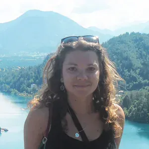
Randonnee dans les gorges de Vintgar - Slovenie
Randonneuse sur les sentiers du GR20 sud - Corse - France
Vue depuis le refuge d'Usciolu sur le GR 20 sud - Corse - France
Village de montagne le long du GR20 sud - Corse - France

Certainly less rugged, with gentler terrain and smaller elevation changes, the southern section of the GR20, from Bavella to Vizzavona, is no exception. It offers its own selection of mountain landscapes with a distinctly Alpine feel, from the Aiguilles de Bavella to the ascent of Monte Alcudine. This guided walking holiday on the GR20 invites you to hike in Corsica safely. If you have an adventurous spirit and would prefer to travel as a pair or with a group of friends, see also the self-guided GR20.

Itinerary

Elevation profile

J2 — Bavella au Cuscionu17.0 km · D+ 1,340 m · D- 1,010 m · 1,014–2,022 m

J3 — Du Cuscionu à Cozzano17.1 km · D+ 650 m · D- 1,460 m · 734–1,810 m

J4 — De Cozzano à Verde19.8 km · D+ 1,860 m · D- 1,310 m · 743–1,990 m

J5 — De col de Verde à Capanelle12.4 km · D+ 1,010 m · D- 710 m · 1,285–1,618 m

J6 — De Capanelle à Vizzavona15.0 km · D+ 680 m · D- 1,370 m · 913–1,641 m

Program

Meet at Ajaccio’s ferry terminal (opposite the Chamber of Commerce and Industry) at 14:00. Meet your mountain walking guide. Transfer by bus to your accommodation at the Col de Bavella. Briefing on your GR20 itinerary.

AccommodationOvernight in a dormitory and dinner at the lodge

From the Col de Bavella, you follow the magnificent balcony trail at the foot of the Aiguilles de Bavella, overlooking the Alta Rocca region. It heads into the Asinao valley to reach the shepherds' huts. The trail climbs to the ridge at an altitude of over 2000m, before descending towards the Cuscione plateau and the shepherds' huts at Croci.

AccommodationOvernight in a dormitory and dinner at the lodge
Distance15km
InfoWalking time: 8 hours
D+Ascent: 1100m
D-Descent: 780m

A beautiful walk through the plateau’s beech woods is followed by a gradual climb, taking you to the northern edge of the plateau, at the foot of the Arête des Statues ridge. Once on the watershed, views alternate between east and west, revealing varied landscapes. You can see the Tyrrhenian Sea stretching as far as the eye can see and, on the western slopes, the villages of Haut Taravo. After crossing the summit, the Usciolu mountain refuge provides a welcome opportunity for a meal break, before leaving the GR 20 and beginning the long descent to Cozzano.

AccommodationOvernight in a dormitory and dinner at the lodge
Distance17km
InfoWalking time: 7 hours
D+Ascent: 650m
D-Descent: 1280m

From the village, the route climbs towards the Col de Laparo. The GR20 follows a rugged trail to the summit of Punta Capella, at almost 2000m. Take one last opportunity to enjoy the views of the eastern plain, which in clear weather reveal the Diana, Urbinu and Palu lagoons, along with the islands of Elba and Monte Cristo. You may have the chance to encounter wild pigs at the edges of the beech, holm oak and maritime pine woods.

AccommodationOvernight in a dormitory and dinner at the lodge
Distance13km
InfoWalking time: 8 hours
D+Ascent: 1200m
D-Descent: 750m

Leaving the Col de Verde, you head inland, where the terrain is gentler. Forests and plant life dominate this section of the route. Fir woods, beech forests and Corsican pines will be your companions for a peaceful, relaxing day of hiking. Everyone will have time to observe this endemic pine (Lariccio), which is the pride of Corsica’s forestry industry. In the shade of the beech trees, the trail follows the contours and every fold of the eastern slopes of the Renoso massif. Towards the end of the stage, a demanding climb awaits, which you will need to tackle carefully to reach the shepherds' huts at Traghjette, then Capannelle.

AccommodationOvernight in a dormitory and dinner at the mountain lodge
Distance13km
InfoWalking time: 5h30
D+Ascent: 710 m
D-Descent: 400 m

The final stage of the southern GR20. The route runs mainly through forest, taking you close to the shepherds' huts at Scarpaceghje and, further on, Alzeta, which are still occupied during the summer. The Monte Renosu massif has a long history of seasonal livestock migration. The GR20 leaves Capanelle (1590m) and, with little change in altitude, takes you to Bocca Palmente (1640m). Once you reach the pass, the views are quite exceptional: to the west, the imposing Monte d’Oro and Rotondu massifs; to the east, the Ghisoni forest, the eastern plain and its lagoons. You will soon reach the Vizzavona forest, where you will remain throughout this pleasant descent in the shade of the beech trees.

Return to Ajaccio

Transfer to Ajaccio by bus. The trip is scheduled to end in the late afternoon, at around 18:00 at Ajaccio’s ferry terminal.

Distance13,5km
InfoWalking time: 5h00
D+Ascent: 450 m
D-Descent: 900 m

We may need to change the itinerary shown, either for logistical reasons (accommodation capacity issues, splitting groups, changes in terrain conditions, rockfalls, damaged trails, etc.) or at the guide’s discretion (weather, the group’s ability, etc.). These changes are always made in your best interests, for your safety and greater comfort!

Specific recommendations for the GR20

Please be aware that, although the GR20 is becoming increasingly popular, it remains Europe’s most difficult trek. Forgetting this could set you up for failure from the outset, or even put you in danger. Do not overestimate your abilities: find out what is involved and prepare properly for your trip!!

It is important to know that, among people tackling the GR20 independently and without support, 70% drop out before completing the route. Thanks to our logistical support and our guides' experience, our completion rate is around 95%. However, taking on the GR20 with us is only suitable for people in good physical condition who already have experience of multi-day treks, with everything that entails: determination, a willingness to push yourself, the ability to live as part of a group and to do without your usual comforts.

If your fitness or technical ability is judged to be insufficient, our guides would have to ask you to stop your GR20 trek for your own safety and for the well-being and cohesion of the group. In addition, if your personal equipment is unsuitable for high-mountain trekking (see our equipment list), we would be unable to let you start the trip for obvious safety reasons.

To avoid losing the money you have paid for your trek (see our terms and conditions of sale), as well as all the difficulties such a situation would cause, we recommend that you find out as much as possible before making your decision. If you are unsure, we recommend choosing one of our introductory GR20 trips to test yourself before attempting the spectacular traverse along the ridges!

It is also worth knowing that Corsica’s mountain refuges are fairly old, have limited capacity and offer only basic comfort (cold showers, few or no toilet facilities, no blankets, etc.). In bad weather or at certain times, the refuges can become overcrowded, and accommodation conditions can be very basic indeed.


Dates, prices and booking

Booking dates are not currently available for this trip. Please check back soon or contact us to plan your journey.

Ask about upcoming departures

Prices include

  • Accommodation
  • Meals from dinner on day 1 to lunch on day 6
  • Local transfers listed in the itinerary
  • Luggage transfers listed in the itinerary
  • Guide services

Prices do not include

  • Personal drinks
  • Insurance
  • Booking fees
  • Visits to attractions
  • Transfers not listed in the itinerary
  • Personal expenses
  • Anything not listed under “Prices include”

Your travel advisors

Cassandre Dufour

Cassandre Dufour

Travel expert in France, Switzerland and Italy.

Write
Estelle Torterotot

Estelle Torterotot

Travel expert in France and Switzerland

Write

Technical and practical information

Excellent physical fitness is required: you must be well trained and able to sustain continuous effort over several days. Previous experience of this activity and regular practice are essential. Expect 6 to 9 hours of walking per day, sometimes more! There are frequent sections away from marked trails. Daily elevation changes exceed 1000m, and mountain trekking experience is essential. There are numerous steep ascents and off-trail sections, along ridges and across rock slabs and rocky terrain. The main challenges are the length of some stages and the nature of the terrain. Just one section, at Bavella, is equipped with a fixed handline.

Each day, you walk carrying your belongings for the day and your lunch. Your travel bag (a sports bag or similar) will be waiting for you at your accommodation each evening. Please limit this bag’s weight to 12kg.

Accommodation

Accommodation in mountain lodges (dormitories sleeping 4 to 20 people). All accommodation has washroom facilities with hot showers and toilets.

Bedbugs:
Bedbugs have appeared in recent years.
Despite pest control treatments, you should check your sleeping area by inspecting the bedding and avoid placing your bag on the bed throughout the trek.
If you wish, we recommend buying a suitable insecticide (e.g. Clako punaises).
At the end of your trek, we recommend placing all your clothes in bags (water-soluble bags are available) before machine washing them. This precaution helps prevent and reduce the risk of spreading bedbugs to other accommodation and your home.

Bathroom facilities:

Like the ageing mountain huts themselves, bathroom facilities are often very basic. Cold showers (or even washing in a river) and a lack of toilets are common. However, we choose our accommodation carefully to ensure you can take a hot shower and enjoy a basic level of comfort.

Meals

Throughout the route, you will be on full board, which includes:

  • Continental breakfast* (tea, coffee, milk, butter, jam and cereals)
  • A hot evening meal* prepared by your accommodation, generally using local produce
  • A picnic lunch* eaten out on the trail, prepared by your accommodation (you must bring a 0.8-litre plastic container to carry your salads)
  • Drinks are not included
  • Snacks suitable for physical activity (dried fruit, cereal bars)

*People with specific dietary requirements or allergies are asked to bring freeze-dried meals suitable for their dietary needs. Mountain huts at high altitude cannot always cater for special diets.

Water treatment:

The island has many springs along the trails and fountains in the villages.
As we cannot guarantee that this water is safe to drink, we recommend treating it chemically with water purification tablets.

From 6 to 12 people

Guiding

Led by a mountain walking guide with a French state qualification.

Meeting point

On Day 1 at 14:00 at Ajaccio ferry terminal (opposite the CCI).

End of the trip

On Day 6 at around 18:00 at Ajaccio bus station.

Ajaccio ferry terminal or airport.

By air

Ajaccio, Bastia, Calvi and Figari airports.

Scheduled or charter airlines:

Airport–bus station shuttle services (Ajaccio)

For timetables, ask at the information desk at the airport or bus station, or contact TCA (tel: 0495232941). Services run every day except 1 May.

Approximate fare: €5

By ferry

Corsica Linea: departures from Marseille, Nice or Toulon

Tel: 0825888088

For more information, visit www.corsicalinea.fr

Corsica Ferries: departures from Nice or Toulon

Tel: 0825095095

For more information, visit www.corsicaferries.com/Pcorsica.srv

La Méridionale: departures from Marseille

Tel: 0970832020

For more information, visit lameridionale.fr

Where to park your car

Car parking (Ajaccio)

Paid, unattended parking: Port de l’Amirauté Charles Ornano car park (near the railway station). Paid, attended parking 24 hours/24 (60 € per week). Diamant car park,

Avenue Eugène Macchini, Tel: 04.95.51.00.85

Car parking (Vizzavona)

Free, unattended parking at the Col de Vizzavona (300m from the Monte Oro hotel and gîte).

  • Public transport in Corsica

Bus routes:

There are numerous bus routes departing from the main towns and cities. Visit: www.corsicabus.org

Chemins de Fer de la Corse railway company:

Bastia, Ponte Leccia, Corte, Vizzavona, Ajaccio line

Bastia, Ponte Leccia, Ile Rousse, Calvi line

  • Left luggage in Ajaccio

Bar du marché (Boulevard du Roi Jérôme), 50metres from the tourist information office. You must purchase a drink or something to eat to leave a bag.

  • Ajaccio

Hôtel Le Dauphin (HT): 0495512996

Hôtel Le Kallisté **: 0495513445

Hôtel Fesch ***: 0495516262

Hôtel Les Mouettes****: 0495504040

Approximately two weeks before your departure, you will receive a notice confirming the meeting time and location, your guide’s name and contact details, and the address of your first accommodation.

Member of Agir pour un Tourisme Responsable (ATR)

Since 2012, Grand Angle has been a member of ATR, the leading association for more responsible tourism. We design our trips – on foot, by bike and on snow – to invite everyone to discover the world differently: with curiosity, respect and kindness.

As members of the board of directors since 2018, we actively help the sector adopt more meaningful practices. In practical terms, we ensure:

  • Transparency in our practices and prices
  • Respect for our partners and local communities
  • Protection of the environment on every trip

We also share the values of the traveller’s ethical charter, which encourages everyone to take simple steps to protect the places they visit and make meaningful connections.

Travelife Partner

Since 2025, Grand Angle has been recognised as a Travelife Partner, an international label that certifies our responsible practices in environmental protection, ethics and sustainable management, both within our company and in our work with partners and the organisation of our trips.

This label, the second level of a rigorous international certification scheme, recognises our concrete actions in support of responsible tourism. We are actively working towards the next level, Travelife Certified, in line with our sustainable development policy

In this section, you will find links to products from our partner Alpinstore, a French online retailer specialising in outdoor equipment, based in Annecy.

For carrying your belongings

  • A comfortable 30 to 50 L backpack with a hip belt to carry your personal belongings and picnic lunch during the day
  • A bag for luggage transfers: a backpack, a travel bag in good condition, or a suitcase that is not too bulky. One bag per person, limited to 15 kg

Discover how to pack your hiking backpack in our magazine.

For hiking

For maximum comfort, choose a layered clothing system: warm base layers (leggings + top) such as “Carline” or “Capilene” (hollow fibres that wick away perspiration) + a sweatshirt or fleece jacket + a mountain jacket and overtrousers with a waterproof, breathable membrane (such as Gore-Tex or equivalent) for bad weather. As a general rule, except in hot climates and countries, avoid cotton, which holds moisture close to the body (and takes a long time to dry), and choose suitable synthetic fabrics instead.

  • Hiking boots with ankle support, a good treaded sole, a supportive heel counter and good waterproofing
  • Comfortable hiking socks (at least 3 pairs)
  • A fleece
  • Comfortable walking trousers (quick-drying technical fabric)
  • Comfortable technical shorts
  • Technical T-shirts or base layers (quick-drying fabric)
  • A long-sleeved shirt
  • Walking poles (telescopic), which are very important for making walking easier. Discover all the benefits of hiking poles in our dedicated article, or how to choose your hiking poles

Note: synthetic technical clothing performs very well. New merino wool clothing is also available; it performs very well, is comfortable to wear and has the advantage of resisting perspiration odours!

For your picnic lunch

  • Your eating kit: a plastic bowl, container or plate, and cutlery (spoon, fork, knife)
  • 1 or 2 water bottles (a total capacity of at least 1,5 L) – compulsory –; an insulated flask for winter

For protection from sun and rain

  • Sunscreen (high protection)
  • Sunglasses
  • A hat, cap or bucket hat
  • A rain poncho or a waterproof jacket such as a softshell or Gore-Tex jacket, and optionally waterproof trousers

After your hike

  • A pair of running-style trainers for the evening
  • A change of clothes and underwear
  • A toiletry bag and a small towel
  • Swimwear and a towel for wellness facilities (where specified) or swimming
  • A small first-aid kit: personal medication, surgical masks, hand sanitiser, plasters, sterile compresses and a bandage, gauze, disinfectant, arnica granules and aspirin, etc. (Please note that this list is not exhaustive and should be adapted to your own medical needs.)
  • A head torch
  • Earplugs (optional)

Find these tips in our article “what to take with you on a hike”.

This list is intended as a guide and should be adapted to your trip and the season in which you are travelling.

Southern Corsica Tourist Office: Place Foch, PO Box 21, 20176 Ajaccio, Tel: 0495515303 - Fax: 0495515301

Corsica Regional Natural Park: 2 rue Major Lambroschini, 20000 Ajaccio, Tel: 0495517910 - Fax: 0495218817

Corsica is, first and foremost, an island, so moisture is ever-present. The Alpine foothills affect the climate locally, and rainfall varies greatly depending on the wind direction. To put it simply, when the libecciu blows (a wind from the southwest), it brings heavy rainfall to the whole western side of Corsica, drenches the island’s highest peaks and becomes a cold, dry wind over eastern Corsica.
The highest recorded rainfall is in Vizzavona and the surrounding area, at 1498 mm. The lowest figures are recorded on the coast, on the Îles Sanguinaires near Ajaccio, at 450 mm, and on the Bonifacio plateau, at 481 mm. The pattern of rainfall is typical of a Mediterranean climate, with little rain in summer, although violent thunderstorms can break out, particularly in mountainous areas. From November to mid-April, it is not unusual to see snow-covered mountains above 1000m. Average coastal temperatures range between 5° and 8° in winter and between 22° and 25° in summer. Naturally, temperatures in mountainous areas vary with altitude. Hikers should be aware that sudden changes in the weather can cause temperatures to drop sharply above 1200m, even in summer. Hikers are therefore strongly advised not to rely on coastal weather conditions and to be prepared for any sudden drop in temperature.

Corsica
Area: 8748 km2
Length: 183km, width: 83km
1000km of coastline

12km from Tuscany and 160km from Provence.
Corsica is surrounded by islands and islets such as Elba and Capraia.

Crystalline Corsica
This makes up the largest part of the island and includes its highest peaks, aligned along a north-northwest to south-southeast axis. These include the volcanic rhyolite massif of Monte Cinto, which is also Corsica’s highest point at 2710m, the granite massif of Rotondo and Monte d’Oro. Further south, the Aiguilles de Bavella form some of the island’s most distinctive and rugged terrain, culminating at the southern tip in the unusual jumble of granite boulders on the mountain of Cagna. Finally, in the northwest, beyond the Cinto massif, the Calanche de Piana merge into the sea.

Alpine or schist Corsica
This occupies the northern and eastern parts of the island and is distinguished by gentler slopes and lower elevations than the central mountain range. Cima di Follicie is the highest point of Cap Corse, at 1322m, rather than Monte Stello (1307m), as guidebooks so often state in error. Further south, Castagniccia, a fertile region rich in chestnut woodland, includes the San Pétrone massif.

The central trough
This boundary zone between Alpine and crystalline Corsica forms a central depression running from L’Île-Rousse to Solenzara via Corte.

The eastern plain
Stretching from Bastia to the mouth of the Solenzara, this area is made up of alluvial deposits that have given rise to lagoons such as Biguglia.

Limestone Corsica
One of the most distinctive features of Corsica’s geology is its limestone outcrops. Although small in extent, these areas are nonetheless remarkable. Examples include the cliffs of Saint-Florent and Bonifacio.

Reviews

4 · 1 review

This trip doesn't have reviews yet. Discover what travelers say about similar trips.

★ ★ ★ ★ ★    Comment sent by Daniel in October

A pleasant trip with a great atmosphere

★ ★ ★ ★ ★    Comment sent by Geneviève in December

Beautiful itinerary with a passionate guide

★ ★ ★ ★ ★    Comment sent by Luc in October

very positive experience in all aspects : great people in the group kept together well by the guide, great landscapes, fitness challenge

★ ★ ★ ★ ★    Comment sent by Maria in June

A wonderful discovery in Corsica!

Would you like to make this a private trip?

Travel with friends or family on dates that suit you. Tell our specialists what you have in mind.

We also recommend

Continue exploring

Guided tours Self-guided Cycling Tailor-made
Dolomites Mont Blanc Danube by bike Madeira All destinations
Guided tours Self-guided Cycling
Tailor-made travel Trip insurance Contact
About us