

Arrival in the charming resort town of Hinterzarten. Check-in at the hotel.
AccommodationNight in a hotel in Hinterzarten
Choose which cookies you accept. Privacy policy
Audience measurement
Google Analytics and Matomo cookies — journeys, searches and bookings.
Targeted advertising
Google Ads, Meta and Effinity — conversions, personalised ads and campaign attribution.
Travel assistant
AI-generated answers. Check important information on our information pages, in your contract or with a human advisor at GrandAngle.Travel.
AI answers — when in doubt, ask an advisor.




With over 1000km of perfectly marked trails, the Black Forest is one of the most beautiful hiking destinations in Germany.
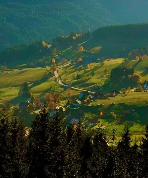
Rolling and hilly landscapes, alternating between legendary forests and meadows with beautiful panoramas, interspersed with charming large farmhouses, magnificent lakes, both intimate and vast, charming and very typical resort villages, and everywhere, a warm and enchanting welcome: the Black Forest will captivate you!
This is a major crossing through the highest peaks, from Feldberg to Belchen, with very open landscapes and panoramas over the Vosges, the Alps, and the Rhine valley on the Germany side.
Each evening, your hosts await you in one of these traditional hotels, typical of the region.
Hover or touch the profile to read the elevation. Keyboard: left and right arrows, Home and End. Escape clears the cursor.
Hover or touch the profile to read the elevation. Keyboard: left and right arrows, Home and End. Escape clears the cursor.
Hover or touch the profile to read the elevation. Keyboard: left and right arrows, Home and End. Escape clears the cursor.
Hover or touch the profile to read the elevation. Keyboard: left and right arrows, Home and End. Escape clears the cursor.
Hover or touch the profile to read the elevation. Keyboard: left and right arrows, Home and End. Escape clears the cursor.
Arrival in the charming resort town of Hinterzarten. Check-in at the hotel.
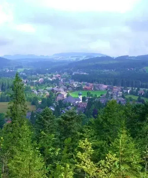
On the “Emil-Thoma” trail, you climb through the forest interspersed with clearings, offering fantastic views of Feldberg (literally: the mountain of the meadows), the summit of the Black Forest. From the summit of Feldberg, admire the fantastic view over Lake Titisee as well as the Alps and the peaks of the “Schwäbischen Alm”. You then cross the “Stübenwasen”, a protected natural park with significant northern and alpine fauna and flora, before descending to Muggenbrunn. A stage dotted with bilberries (in full season!).
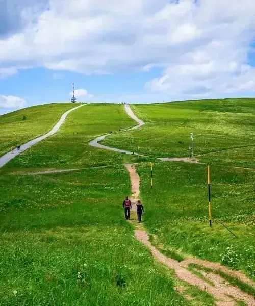
Today, alternating between dense forests and magnificent viewpoints. Your highest point is Belchen (1414m), the most beautiful peak of the Black Forest. In clear weather, the view of the Alps, from Austria to Mont Blanc, is particularly spectacular. From Belchen, either you continue on foot to Münstertal where you spend the night, or you descend to Haldenhof where you take a bus to Tergenau where your host will pick you up.
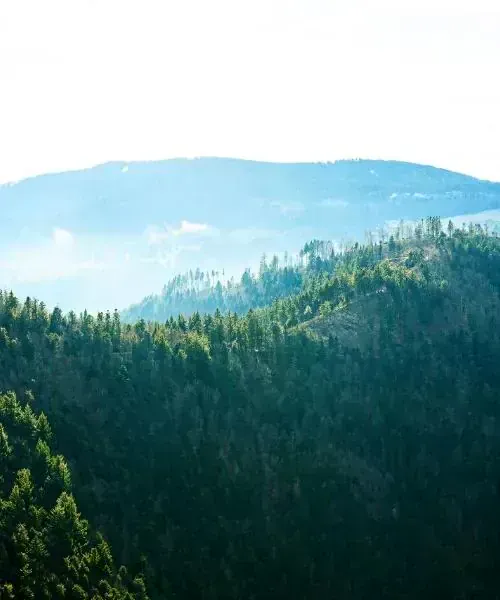
If you spent the night in Münstertal, a taxi will pick you up and drop you off at the start of your day’s stage. Otherwise, you can either start the day on foot or take a bus to return to Haldenhof and do the entire stage (+ 5 or 6km). A beautiful varied and peaceful stage that takes you from the Belchen region to the gentle summit of Blauen (1165m), which will offer you a panorama of the Black Forest, the Alsace plain, the Vosges, the Jura and the Alps. You leave behind the cool pastures and mountains of the Black Forest to cross the ridges of the south-west of the Markgräflerland and a charming valley leads you to the village of Kandern. Its Blumenplatz, “flower square”, is one of the most beautiful market squares in southern Germany.
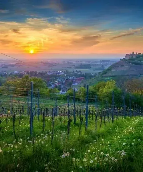
We leave the small town of Kandern and the High Black Forest to reach Weil-am-Rhein, via the last foothills of the south-west Black Forest and the rich Markgräflerland region. You continue via Egisholz and the pretty village of Rotteln, with its medieval castle perched on the eastern slope of the Wiesental. A final climb will take you to the panoramic viewpoint of Tüllinger Höhe overlooking the beautiful city of Basel. The vineyards on the slopes of the Wiese, which soon joins the Rhine, lead you to the gates of Basel. Night in hotel in Weil am Rhein, a few kilometres from Basel, easily accessible by train.
N.B.: the stage ends at Weil im Rhein, 6km from Basel; from a hiking perspective, it is more interesting.
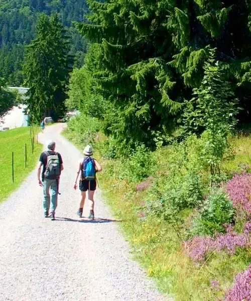
Hikers on the Black Forest trail
End of stay after breakfast. Your return by train from Weil am Rhein to Hinterzarten is at your own expense.
If you wish to extend your stay, please contact us.
We may sometimes need to modify the indicated itinerary: either at the organisational level (accommodation overload issues, changes in terrain condition, rockfalls, degraded paths, etc.), or due to weather conditions. These modifications are always made in your interest, for your safety and for greater comfort!
Departure date at your convenience, every day except Saturday (subject to availability) from 18 April to 13 October 2026 (last departure).
Price 2026 per person in 2, room on bed and breakfast basis:
| 1 person | 2 to 3 people | 4 to 5 people | 6 people and more |
|---|---|---|---|
| 1110€ | 910 € | 900 € | 890 € |
Price 2027 per person in 2, room on bed and breakfast basis:
| 1 person | 2 to 3 people | 4 to 5 people | 6 people and more |
|---|---|---|---|
| 1165€ | 960 € | 950€ | 940 € |
*Prices 2027 subject to revision in autumn 2026

Giovanna Crippa
Product Manager Europe
Kristiina Gaillard
Alps and Scandinavia travel expert
Level 3/5
Moderate to good walker, 5 to 7 h of effective walking and approximately twenty km per day, without technical difficulty. In a few places, the trail has an alpine character, meaning it is narrow, steep and scattered with roots and stones. You need a steady foot, but there are no climbing passages. Elevation gain: +440 to +720m per day.
Nothing to carry: you only carry a small backpack with the picnic and your day items. You find your luggage every evening at the accommodation. (1 bag per person, 20kg maximum)
No personal transfers planned in the program; however, on the High Black Forest section of the route you benefit from a guest card that allows you to take regional buses and trains for free.
From 1 person.
6 days, 5 nights and 4 days hiking.
From mid-April to mid-October.
No guided tour. Travel file with itinerary description, GPX traces and exchange vouchers. One file per room. We can provide you with a hiking guide for the Black Forest (Hikeline) with a description of each stage for an additional fee. This book is available only in German.
You receive your travel folder typically 2 to 3 weeks before departure, after settlement of the balance.
Hotel or Gasthof 3*, in a 2 room with bathroom, exceptionally in a guest house of equivalent comfort.
Single room available on request for an additional fee.
Some hotels are equipped with a swimming pool or sauna: bring your swimsuit.
For double rooms, there is rarely the same difference as we have between a double (large bed for 2) and a twin (2 separate beds): most often the bed consists of two mattresses of 90 cm placed side by side but equipped with individual sheets and duvets.
Hotel or Gasthof? Germans and Austrians themselves are often quite confused explaining the difference… The Gasthof is generally run by a family and has existed for several generations; it will often be more typical. The hotel is generally a more impersonal and newer establishment… which does not prevent Gasthofs from having impressive “facelifts” regularly! But this difference is especially valid in large cities (you will find chain hotels, never chain gasthofs).
Breakfast is included. Most hotels also offer meals; if not, a restaurant is nearby. Some stages offer little or no dining options. It is therefore essential to carry enough provisions for the entire day in your backpack! When possible, take advantage of the route to stop at an inn: German soups, hearty yet delicious, are inexpensive and ideal for a lunch break… at any time of day!
Day 1, in the afternoon, in Hinterzarten.
Day 6, after breakfast, in Weil am Rhein.
Basel airport, then train and bus to Hinterzarten, via Basel and Freiburg am Breisgau.
Hinterzarten station (about thirty km from Freiburg am Breisgau) on the outbound journey, from Basel or Weil am Rhein on the return. Trains from Paris:
Example: Departure 07h20 Gare de l’Est; Arrival 11h43 Hinterzarten station (connections at Karlsruhe and Freiburg-im-Breisgau) Check timetables and rates for German railways on Deutsche Bahn. Check timetables and rates for Swiss railways on CFF.
Paris – Hinterzarten: approximately 6 hours driving. Lyon – Hinterzarten: approximately 4 hours 30 minutes driving.
Hinterzarten is about thirty km from Freiburg am Breisgau and about a hundred km from Basel. Return from Basel (or Weil am Rhein) to Hinterzarten by train + bus: 1h50 (or 2h00), via Freiburg.
Check your route on ViaMichelin.
You can leave your vehicle in Hinterzarten for the week (station parking; approximately 15 € per week, to be verified on site).
We provide you with train schedules between Weil am Rhein and Hinterzarten in your travel folder. The journey is at your expense. Allow approximately 1h30 to 2 hours with one or two connections.
Note: the access information above is provided as a guide, subject to availability, and should be verified before your departure.
A number of our trips offer swimming opportunities, either during the day or at the end of the day. It would be a shame not to take advantage of them! However, we emphasize that you are the sole judge of whether swimming is appropriate; these swimming activities are therefore undertaken at your own responsibility and risk.
Since 2012, Grand Angle is a member of ATR, the reference association for more responsible tourism. We design our trips – on foot, by bike, on snow – to invite everyone to discover the world differently: with curiosity, respect, and kindness.
Present on the board of directors since 2018, we actively contribute to evolving sector practices toward greater meaning. Concretely, we ensure:
We also share the values of the traveller’s ethical charter, which encourages everyone to adopt simple actions to protect the places visited and foster meaningful encounters.
Since 2025, Grand Angle is recognized as a Travelife Partner, an international label that certifies our responsible practices regarding environment, ethics, and sustainable management, both within our company and with our partners and in the organization of our trips.
This label, the second level of a demanding international certification, certifies our concrete actions in favor of responsible tourism. We actively pursue our progress toward the higher level, Travelife Certified, in accordance with our sustainable development policy
In this section you will find links to products from our partner Alpinstore, a French e-commerce site specializing in outdoor equipment, based in Annecy.
To carry your belongings
Discover in our Mag how to pack your hiking backpack properly.
For Hiking
For maximum comfort, favor a “layering” system of clothing: warm underwear (long underwear + base layer) like “Carline” or “Capilene” (hollow fibers that wick away perspiration) + sweater or fleece jacket + mountain jacket and waterproof pants with breathable membrane (like “Gore-Tex” or equivalent) for bad weather. Generally, and outside hot climates and countries, avoid cotton, which retains moisture against the body (and dries slowly), in favor of appropriate synthetic materials.
Note: synthetic technical clothing is highly effective. New merino wool garments have also emerged; they are very effective and pleasant to wear, and have the advantage of not developing sweat odours!
For the midday picnic
Against sun and rain
After the effort
Find these tips in our article #"what to bring on a hike".
This list is provided as an indication and should be adapted depending on the trip and the season in which you are travelling.
Valid identity card or French, Belgian or Swiss passport. Canadians must bring their passport, but are exempt from visas. Since 2012, children must have their own identity card or their own passport.
Obtain the European Health Insurance Card from your Social Security office (or log into its website) which will send it to you within around two weeks. It is a blue plastic card in the same format as a national health card. It is valid for one year, free of charge, and personal (each family member must have their own, including children). This card certifies your health insurance rights and will allow you, during a temporary stay in Europe, to benefit from coverage of medically necessary care, regardless of the reason for your travel, subject to complying with the procedures in force in the country of stay. Please note: the card is not valid for care provided in private establishments.
German National Tourist Office
Website: www.germany.travel
From France to Germany: 0049 + area code + correspondent’s number.
From Germany to France: 0033 + correspondent’s number with 9 digits (do not dial the 0).
Same time as France.
The official language is German.
Each region has its own dialect with its own characteristics. In total, there are around 20 different ones. Even some cities have their own dialect, such as Berlin or Cologne. But don’t worry, you will be able to make yourself understood by everyone.
So that you don’t get lost during your trip and can also speak with Germans you meet, we have compiled some important terms for your trip to Germany:
Hello Guten Tag
Hi Hallo
Thank you Danke
Please Bitte
Yes Ja
No Nein
How are you? Wie geht es Ihnen / dir? I am well Mir geht es gut.
The Euro = €
Exchange and payment
The best solution is to withdraw cash from ATMs using an international payment card as needed. ATMs can be found almost everywhere.
For Swiss and Canadian citizens, there are exchange offices at airports, borders, and train stations in major cities. For euro withdrawals at ATMs, generally no commission if your account is in the eurozone; check with your bank if this is not the case.
In general, the climate in Germany is said to be identical to that of France. The climate is temperate, typical of Central Europe. However, the east-west and north-south distances, as well as the many different landscape features, result in significant regional climate variations.
Southwestern Germany, with its greater distance from the sea, has a temperate continental climate. Here, it is mild year-round, but mountain regions are well covered in snow. The highest average annual temperatures in Germany are measured in this region.
Cuisine
In Germany, traditional folk cuisine (or popular cuisine) is widely spread. Here, people enjoy eating the dishes that our grandparents already prepared.
You can discover great regional diversity. German recipes vary from north to south, east to west. In almost every region, there are typically German recipes that define the identity of these regions.
In the Black Forest, taste the ‘Schwarzwälder Kirschtorte’ (commonly called “Black Forest cake” in our parts), a large cake made of cherries, sponge cake, chocolate and plenty of whipped cream. It’s a real high-calorie delicacy, but you’ll love it!
Some famous festivals
_
The carnival, also called ‘fasching’, is truly a fifth season for Germans. It starts 11 November and ends around March. Carnival in Germany is particularly celebrated in Rhineland, Mainz, Düsseldorf and Cologne. People wear colorful and creative costumes and celebrate with music. The highlight of carnival is the weekend before Ash Wednesday: from Thursday to Tuesday, the street carnival takes place, during which decorated floats accompanied by music and dances parade through the streets
_
Oktoberfest, the beer festival, is the most famous German festival and the largest folk festival in the world. It takes place every year for more than 200 years from September to October during 16 to 18 days in Munich. Germans also call it ‘Wiesn’. During Oktoberfest, beer flows freely, but it’s also a huge folk festival with many attractions. Many Germans follow the traditional dress code: men wear leather pants and a shirt and women wear a ‘dirndl’ (a Bavarian costume/dress).
History
_
German history is characterized by the division between East and West Germany. The wall was built in 1961 to stop the flow of refugees from the East. On 9 November 1989, , Germany’s most hated building fell. At that time, the GDR was on the verge of collapse, it was in economic and political bankruptcy. The national border was opened and the unification of the two German states began. Even today, you can see some remnants of the wall, especially in Berlin.
4,8 · 6 reviews
Didier 7/31/26
— Sports-oriented, an interesting encounter with German culture.
Monique 7/31/26
— A really enjoyable hike back to my roots!
—
— Reply from the team
Would you like to make this a private trip?
Travel with friends or family on dates that suit you. Tell our specialists what you have in mind.

Currently unavailable
4 · 2 reviews

From €1,690
4,6 · 21 reviews

From €975
4,3 · 3 reviews

From €3,040
4,6 · 21 reviews

From €5,835
4,6 · 17 reviews

From €575
4 · 2 reviews

48 trips

48 trips

13 trips

13 trips

74 trips

50 trips
25 trips
24 trips

18 trips
12 trips

12 trips

10 trips

16 trips

10 trips

48 trips

31 trips

30 trips

23 trips
23 trips

21 trips

18 trips

17 trips
Your next adventure
Confirmed trips only
No trip matches — let us guide you Need help choosing?
Call us